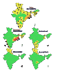
The Southwest Monsoon has advanced into some more parts of central Arabian Sea, entire Goa, some parts of Konkan, Madhya Maharashtra & Marathwada, remaining parts of Karnataka, entire Rayalaseema & Coastal Andhra Pradesh, most parts of Telangana, some parts of south Chhattisgarh and south Odisha, some more parts of west-central & north Bay of Bengal, remaining parts of Nagaland, Manipur, Mizoram & Tripura, most parts of Arunachal Pradesh and some more parts of Assam & Meghalaya, says the weather forecast reports.
Heavy Rainfall to Lash over These Parts of India due to Southwest Monsoon
Under the influence of this Low-Pressure Area, scattered heavy to very heavy with isolated extremely heavy rainfall likely over Coastal Andhra Pradesh & Yanam, Telangana, Coastal Karnataka, Vidarbha and Konkan & Goa during next 2-3 days and isolated heavy to very heavy rainfall likely over Interior Karnataka, Interior Maharashtra and Odisha during next 2 days.

Conditions are becoming favourable for further advance of Southwest Monsoon into some more parts of Central Arabian Sea and Maharashtra (including Mumbai); remaining parts of Telangana, west-central and North Bay of Bengal, Arunachal Pradesh & Assam & Meghalaya, entire Sikkim, some more parts of Odisha and some parts of West Bengal during next 48 hours.
The low-pressure area lies over west-central & adjoining Northwest Bay of Bengal off north Andhra Pradesh-south Odisha coasts. It is very likely to move west-northwestwards.
As per yesterday’s reports, maximum temperatures are appreciably above normal (3.1°C to 5.0°C) at many places over Sub-Himalayan West Bengal & Sikkim; above normal (1.6°C to 3.0°C) at most places over West Rajasthan; at many places over Arunachal Pradesh; at a few places over Assam while minimum temperatures are appreciably above normal (3.1°C to 5.0°C) at isolated places over Sub-Himalayan West Bengal & Sikkim.


