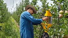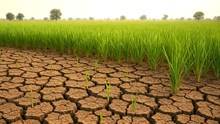
Remote sensing is termed as the art and science of collecting data related to items or places from a distance without the need to have physical contact with items or the place being studied.
The technique of remote sensing is utilized in the field of agriculture and its related domains through the following means:
-
Monitoring the growth of crops through the collection of basic data.
-
Getting an estimate of the area under cropping.
-
Forecasting the yield.
-
Getting detailed information about the wastelands.
-
Assessing and monitoring the areas prevailing drought conditions
-
Assessing the areas affected with floods and the getting an account of the damage.
-
Estimating the area covered by forests and determining the land use.
-
Mapping of soil.
-
Getting an estimate of the moisture content, irrigation requirement, ad drainage system of the soil.
-
Keeping check of any pest or disease outbreak.
-
Assessing the ground water situation.
Role of Remote Sensing in Agriculture
Agricultural resources are crucial renewable natural resources that are dynamic in nature. In India, the agriculture sector is the primary source of income for around 70 percent of the inhabitants and has a share of about 35 percent of the net national product. With limited area available for agricultural practices, the only solution is through increased productivity in the limited area available. Therefore, sensible and sustainable use of land and water resources becomes a main concern. Hence, broad and consistent knowledge of land use/area, forest cover, soil, geological data, area under wastelands, agricultural crops, underground and surface water resources, and hazards/natural disasters like drought and floods are essential.
Season-wise data on crops, the area they cover, and yield helps the nation to make use of appropriate measures to meet shortages, if any, and apply appropriate support and procurement measures. Remote Sensing devices, have the potential of delivering regular, descriptive, multi-temporal and multi-spectral coverage of the nation, and therefore play a vital role in collecting and delivering such data.
Indian Remote Sensing initiatives:
India, after gaining knowledge and experience from BHASKARA-I and II, experimental missions related to remote sensing satellites, has now introduced remote sensing systems based on satellites. These operational remote sensing systems are launched with the help of the Indian Remote Sensing Satellite IRS-IA in 1988, IRS- IB I 1992, IRS-IC in 1995, and IRS- ID in 1997.
The nodal agencies responsible for the establishment of the Indian Remote Sensing System are the Indian Space Research Organisation (ISRO) and The Department of Space (DOS). They started efforts in the 1970s for analysing the potential related to remotely sensed data with the help of several means.


